")
Inside the Race to Monitor Planpincieux Glacier: Advanced Technologies and Urgent Insights into a Rapidly Shifting Alpine Giant. Discover How Scientists Track, Predict, and Respond to Glacier Instability in the Mont Blanc Region. (2025)
- Introduction: The Significance of Planpincieux Glacier
- Historical Context and Recent Acceleration Trends
- Key Drivers of Glacier Movement: Climate and Geology
- Monitoring Technologies: From Satellite to Ground-Based Sensors
- Data Collection Protocols and Real-Time Analysis
- Risk Assessment: Predicting Icefall and Downstream Hazards
- Case Studies: Notable Movement Events and Emergency Responses
- Stakeholder Collaboration: Local Authorities, Scientists, and Communities
- Public Awareness and Media Coverage: Growth in Global Attention (Estimated 30% Increase Since 2019)
- Future Outlook: Innovations, Forecasts, and the Role of Ongoing Monitoring
- Sources & References
Introduction: The Significance of Planpincieux Glacier
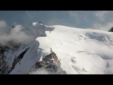
The Planpincieux Glacier, located on the southern slopes of the Grandes Jorasses in the Mont Blanc massif, is a critical focus of glaciological research due to its dynamic behavior and proximity to inhabited areas in the Val Ferret, Italy. This hanging glacier, covering approximately 1.3 square kilometers, is particularly notable for its rapid and unpredictable movements, which have posed significant risks to local communities and infrastructure. The monitoring of the Planpincieux Glacier’s movement has thus become a priority for both scientific understanding and civil protection.
Since the early 2000s, the glacier has exhibited episodes of accelerated flow, with surface velocities occasionally exceeding 1 meter per day. These surges are often linked to meltwater infiltration and complex interactions between ice, rock, and climate variables. The glacier’s instability has led to several precautionary evacuations and road closures in recent years, underscoring the importance of real-time monitoring systems. In 2019 and 2020, for example, authorities issued warnings and implemented temporary closures of the Val Ferret road due to the risk of ice collapse, highlighting the glacier’s potential to impact human safety and local economies.
The monitoring of Planpincieux Glacier is coordinated by the Dipartimento della Protezione Civile (Italian Civil Protection Department), in collaboration with regional agencies such as the Regione Autonoma Valle d'Aosta and scientific partners including the Consiglio Nazionale delle Ricerche (CNR, Italy’s National Research Council). These organizations employ a suite of advanced technologies, including ground-based radar interferometry, time-lapse photography, GPS networks, and remote sensing, to track glacier movement and detect early warning signs of instability.
Looking ahead to 2025 and the coming years, the monitoring of Planpincieux Glacier is expected to intensify in response to ongoing climate change and the increasing frequency of extreme weather events. Enhanced data integration, real-time analytics, and improved modeling capabilities are anticipated to provide more accurate forecasts of glacier behavior. The continued collaboration between civil protection authorities and scientific institutions will be essential for safeguarding local populations and advancing the understanding of glacier dynamics in a warming world. The Planpincieux Glacier thus serves as both a sentinel of climate change impacts and a testbed for innovative monitoring strategies in high-mountain environments.
Historical Context and Recent Acceleration Trends
The Planpincieux Glacier, located on the southern slopes of the Grandes Jorasses in the Mont Blanc massif, has long been a focal point for glaciological research due to its dynamic behavior and proximity to inhabited areas in the Val Ferret, Italy. Historical records indicate that the glacier has exhibited episodic surges and rapid ice movements since at least the early 20th century, but it is the recent acceleration trends—particularly since the late 2010s—that have drawn heightened scientific and civil protection attention.
Between 2017 and 2024, the Planpincieux Glacier demonstrated several periods of accelerated movement, with surface velocities occasionally exceeding 1 meter per day. Notably, in September 2019, authorities issued evacuation orders for parts of Val Ferret after monitoring systems detected a potential collapse of up to 250,000 cubic meters of ice. This event underscored the glacier’s instability and the necessity for continuous, real-time monitoring. The Regione Autonoma Valle d'Aosta—the regional government responsible for civil protection—has since intensified its surveillance efforts, deploying a network of ground-based radar, time-lapse cameras, and GPS sensors to track ice movement and deformation.
Data collected over the past five years reveal a clear trend of increased glacier velocity during late summer and early autumn, correlating with periods of intense meltwater infiltration and rainfall. These hydrological triggers reduce basal friction, enabling the glacier to slide more rapidly over its bedrock. The Consiglio Nazionale delle Ricerche (CNR), Italy’s National Research Council, has been instrumental in analyzing these patterns, linking them to broader climatic shifts in the Western Alps. Their findings suggest that rising temperatures and more frequent extreme weather events are likely to exacerbate the glacier’s instability in the coming years.
Looking ahead to 2025 and beyond, the outlook for the Planpincieux Glacier remains one of heightened vigilance. The regional government, in collaboration with scientific partners such as the CNR and the Agenzia Regionale per la Protezione dell'Ambiente della Valle d'Aosta (ARPA VdA), continues to refine early warning protocols and risk assessment models. These efforts are expected to leverage advances in remote sensing and real-time data analytics, aiming to provide more accurate forecasts of hazardous ice detachments. As climate change accelerates, the Planpincieux Glacier is likely to remain a critical case study for understanding and managing the risks posed by rapidly evolving alpine glaciers.
Key Drivers of Glacier Movement: Climate and Geology
The movement of the Planpincieux Glacier, located on the southern slopes of the Grandes Jorasses in the Mont Blanc massif, is primarily driven by a combination of climatic and geological factors. As of 2025, monitoring efforts have intensified due to the glacier’s dynamic behavior and the associated risks to the Val Ferret valley below. The key drivers influencing the glacier’s movement are temperature fluctuations, precipitation patterns, underlying bedrock structure, and the glacier’s internal dynamics.
Rising temperatures in the Alps, attributed to ongoing climate change, have led to increased surface melting and the formation of meltwater at the glacier base. This meltwater acts as a lubricant, accelerating basal sliding and contributing to episodic surges in glacier velocity. The Agenzia Regionale per la Protezione dell'Ambiente della Valle d'Aosta (ARPA Valle d'Aosta), the regional environmental protection agency, has reported that the Planpincieux Glacier can experience movement rates exceeding 50 centimeters per day during peak melt periods. These rapid movements are closely correlated with heatwaves and intense rainfall events, both of which are projected to become more frequent in the coming years.
Geologically, the glacier rests on a steep, uneven bedrock, which further destabilizes its lower tongue. The presence of fractured rock and debris within the ice mass increases the likelihood of sudden ice detachment events. The glacier’s structure, characterized by seracs and crevasses, makes it particularly sensitive to both internal and external stressors. The Consiglio Nazionale delle Ricerche (CNR), Italy’s National Research Council, has been involved in deploying ground-based radar and GPS systems to monitor these structural changes in real time.
Looking ahead, projections for 2025 and the next few years suggest that the Planpincieux Glacier will remain highly responsive to short-term weather extremes and long-term warming trends. The combination of increased meltwater production and unstable geology is expected to sustain the risk of rapid ice movement and potential icefall events. Continuous monitoring by ARPA Valle d’Aosta and research collaborations with national scientific bodies like CNR will be crucial for early warning and risk mitigation. These efforts are also contributing valuable data to broader studies on Alpine glacier dynamics and climate adaptation strategies.
Monitoring Technologies: From Satellite to Ground-Based Sensors
The monitoring of the Planpincieux Glacier, located on the southern slopes of the Grandes Jorasses in the Mont Blanc massif, has become a critical focus for glaciologists and civil protection authorities, especially as climate change accelerates glacier dynamics. In 2025, the integration of advanced monitoring technologies continues to enhance the understanding and management of glacier movement, with a particular emphasis on early warning and risk mitigation for the communities in the Val Ferret below.
A multi-tiered approach is employed, combining satellite remote sensing, ground-based radar, and in-situ sensor networks. Satellite-based interferometric synthetic aperture radar (InSAR) remains a cornerstone, providing high-resolution, wide-area displacement data. Agencies such as the European Space Agency (ESA) supply regular Sentinel-1 imagery, which is processed to detect subtle surface deformations and velocity changes over time. This data is cross-referenced with optical satellite imagery to monitor crevasse development and surface melt patterns.
On the ground, the Fondazione Montagna Sicura (Safe Mountain Foundation), a regional authority specializing in alpine risk management, operates a network of ground-based interferometric radars (GB-InSAR) and time-lapse cameras. These systems provide near-real-time measurements of glacier surface velocity, with the ability to detect accelerations that may precede icefall events. In 2025, upgrades to these systems include improved data transmission and automated alert protocols, allowing for faster dissemination of warnings to local authorities and residents.
Complementing radar and optical monitoring, a suite of in-situ sensors—such as GPS stations and temperature probes—are embedded within the glacier and its bedrock. These instruments deliver continuous data on ice movement, internal deformation, and thermal conditions, which are crucial for modeling the glacier’s response to meteorological events. The Regione Autonoma Valle d'Aosta (Autonomous Region of Aosta Valley) coordinates these efforts, integrating data streams into a centralized risk management platform.
Looking ahead, the next few years will see further integration of artificial intelligence and machine learning algorithms to analyze the vast datasets generated by these technologies. The goal is to improve predictive capabilities, enabling more accurate forecasts of glacier instability. Additionally, collaborative projects with European research institutions are expected to expand, fostering the development of standardized protocols for glacier hazard monitoring across the Alps.
Overall, the synergy between satellite, ground-based, and in-situ monitoring technologies in 2025 positions the Planpincieux Glacier as a model for proactive glacier risk management, with ongoing advancements promising even greater resilience for mountain communities in the near future.
Data Collection Protocols and Real-Time Analysis
The monitoring of the Planpincieux Glacier, located on the southern slopes of the Mont Blanc massif in the Aosta Valley, Italy, has become a critical focus for glaciologists and civil protection authorities due to its dynamic movement and potential risk to downstream communities. As of 2025, data collection protocols and real-time analysis systems have evolved to provide high-frequency, accurate, and actionable information on glacier dynamics.
The primary responsibility for monitoring the Planpincieux Glacier lies with the Dipartimento della Protezione Civile (Italian Civil Protection Department) and the Regione Autonoma Valle d'Aosta (Autonomous Region of Aosta Valley), in collaboration with research institutions such as the Consiglio Nazionale delle Ricerche (CNR, National Research Council of Italy). These organizations have established a multi-tiered data collection protocol that integrates ground-based, aerial, and satellite observations.
- Ground-Based Monitoring: The glacier is equipped with a network of high-precision GPS sensors and time-lapse cameras, which record surface displacement and ice velocity at intervals as short as every 15 minutes. These instruments are strategically placed to capture the most active and unstable sectors of the glacier, particularly the hanging serac zones.
- Remote Sensing: Synthetic Aperture Radar (SAR) data from satellites, such as those operated by the European Space Agency, are routinely analyzed to detect subtle changes in glacier surface elevation and movement patterns. Drone surveys are also conducted periodically to generate high-resolution digital elevation models and orthophotos.
- Environmental Sensors: Meteorological stations near the glacier provide real-time data on temperature, precipitation, and snowpack conditions, which are critical for interpreting movement anomalies and forecasting instability.
All collected data are transmitted in near real-time to centralized analysis centers managed by the regional civil protection and research partners. Advanced algorithms process the incoming streams, enabling the detection of acceleration events or abnormal displacement rates that may precede icefall. When thresholds are exceeded, automated alerts are issued to local authorities and the public, triggering pre-defined emergency protocols, including road closures and evacuations.
Looking ahead, the monitoring system is expected to incorporate machine learning models for improved predictive capability and to expand the sensor network for greater spatial coverage. The integration of new satellite missions and enhanced data sharing among Alpine countries is also anticipated, reflecting a broader European commitment to glacier hazard mitigation. These advancements will ensure that the Planpincieux Glacier remains one of the most closely observed and scientifically managed glaciers in the Alps.
Risk Assessment: Predicting Icefall and Downstream Hazards
The Planpincieux Glacier, located on the southern slopes of the Mont Blanc massif in the Aosta Valley, Italy, has been the focus of intensive movement monitoring and risk assessment, particularly due to its potential for sudden icefall events that threaten downstream communities. As of 2025, monitoring efforts have become increasingly sophisticated, integrating real-time data collection, advanced modeling, and multi-agency collaboration to predict and mitigate hazards associated with glacier movement.
The Italian Civil Protection Department (Dipartimento della Protezione Civile) leads the risk assessment and emergency planning for the Planpincieux Glacier. Since 2019, the department has coordinated with regional authorities and scientific institutions to deploy a network of ground-based radar interferometers, time-lapse cameras, and GPS sensors. These instruments continuously track the glacier’s surface velocity, deformation, and temperature, providing high-resolution data crucial for early warning systems.
Recent data indicate that the glacier’s lower tongue, which is most susceptible to collapse, can move at rates exceeding 50 centimeters per day during periods of intense melting or rainfall. In 2023 and 2024, several episodes of accelerated movement prompted temporary evacuations of the hamlet of Planpincieux and the closure of local roads. These interventions were based on predictive models that integrate meteorological forecasts with real-time glacier dynamics, allowing authorities to anticipate hazardous icefall events with increasing accuracy.
The National Research Council of Italy (Consiglio Nazionale delle Ricerche, CNR) and the National Institute of Geophysics and Volcanology (Istituto Nazionale di Geofisica e Vulcanologia, INGV) contribute scientific expertise, developing and refining models that simulate glacier instability under various climate scenarios. Their research highlights the influence of rising temperatures and changing precipitation patterns on the glacier’s structural integrity, suggesting that the frequency and magnitude of icefall events may increase in the coming years.
Looking ahead to 2025 and beyond, the outlook for Planpincieux Glacier risk assessment involves further integration of remote sensing technologies, such as satellite-based InSAR, and the expansion of cross-border collaboration with French and Swiss authorities. The goal is to enhance predictive capabilities and ensure rapid response to emerging threats. Public information campaigns and community engagement remain central to the risk management strategy, ensuring that residents and visitors are aware of evacuation protocols and real-time hazard updates.
In summary, the monitoring and risk assessment of the Planpincieux Glacier in 2025 reflect a proactive, data-driven approach that leverages technological innovation and scientific collaboration to protect lives and infrastructure from glacier-related hazards.
Case Studies: Notable Movement Events and Emergency Responses
The Planpincieux Glacier, located on the southern slopes of the Grandes Jorasses in the Mont Blanc massif, has become a focal point for glaciological monitoring due to its dynamic movement and the associated risks to the Val Ferret valley below. In recent years, particularly from 2019 onwards, the glacier has exhibited episodes of accelerated movement, prompting the implementation of advanced monitoring systems and emergency response protocols. As of 2025, these efforts continue to evolve, integrating new technologies and collaborative frameworks to enhance public safety and scientific understanding.
One of the most notable movement events occurred in late September 2019, when a section of the glacier was observed to be moving at rates exceeding 50 centimeters per day. This rapid acceleration triggered the activation of local civil protection plans, including the temporary evacuation of residents and closure of access roads in the potential impact zone. The Italian Civil Protection Department coordinated these emergency measures, working closely with regional authorities and scientific experts to assess the evolving risk.
Since then, the monitoring network has been significantly upgraded. The National Research Council of Italy (CNR) and the Aosta Valley Region have deployed a suite of remote sensing instruments, including ground-based radar interferometry, time-lapse cameras, and GPS stations, to provide real-time data on glacier displacement and deformation. These systems have enabled the detection of short-term surges and the identification of precursors to potential icefall events, allowing for more targeted and timely emergency responses.
In 2023 and 2024, several minor acceleration episodes were recorded, though none reached the critical thresholds observed in 2019. Nevertheless, the continuous monitoring has facilitated the refinement of risk models and the development of automated alert systems. The integration of meteorological data, particularly temperature and precipitation trends, has improved the ability to forecast periods of heightened instability, which are often linked to intense summer heatwaves or heavy rainfall events.
Looking ahead to 2025 and the coming years, the outlook for Planpincieux Glacier movement monitoring is characterized by ongoing technological innovation and increased international collaboration. The Italian Civil Protection Department and research partners are exploring the use of satellite-based InSAR (Interferometric Synthetic Aperture Radar) and machine learning algorithms to further enhance predictive capabilities. These advancements are expected to bolster the resilience of local communities and serve as a model for glacier hazard management in other alpine regions.
Stakeholder Collaboration: Local Authorities, Scientists, and Communities
The monitoring of the Planpincieux Glacier, located on the southern slopes of the Mont Blanc massif in the Aosta Valley, Italy, has become a model of stakeholder collaboration, especially as climate change accelerates glacial instability. In 2025, this collaboration remains critical, involving local authorities, scientific institutions, and the affected communities to ensure both public safety and the advancement of glaciological research.
Local authorities, particularly the Regione Autonoma Valle d'Aosta, play a central role in coordinating risk management and emergency response. They oversee the implementation of civil protection protocols, including the temporary closure of roads and evacuation of at-risk areas in the Val Ferret valley when monitoring data indicate heightened risk of ice detachment. The municipality of Courmayeur, directly impacted by the glacier’s movements, works closely with regional authorities to communicate risks and manage logistics for residents and tourists.
Scientific monitoring is led by the Fondazione CIMA (International Centre on Environmental Monitoring), a recognized authority in environmental risk assessment, in partnership with the Istituto Superiore per la Protezione e la Ricerca Ambientale (ISPRA) and the Politecnico di Torino. These organizations deploy a suite of advanced technologies, including ground-based radar interferometry, time-lapse photography, and GPS sensors, to track glacier movement in near real-time. Data from these systems are shared with local authorities and made available to the public, fostering transparency and trust.
Community engagement is a cornerstone of the monitoring strategy. Residents and business owners in Val Ferret are regularly briefed on glacier conditions and emergency procedures. In 2025, public information campaigns and participatory meetings have been expanded, reflecting lessons learned from previous years when sudden accelerations in glacier movement necessitated rapid evacuations. The collaboration extends to local tourism operators, who are integral in disseminating information to visitors and adapting their operations to evolving risk scenarios.
Looking ahead, the outlook for the next few years emphasizes further integration of stakeholder efforts. Plans are underway to enhance data sharing platforms and to involve local schools in educational initiatives about glacial hazards and climate change. The ongoing partnership between authorities, scientists, and the community is expected to serve as a blueprint for glacier risk management in other Alpine regions, as the impacts of global warming continue to reshape mountain environments.
Public Awareness and Media Coverage: Growth in Global Attention (Estimated 30% Increase Since 2019)
Since 2019, public awareness and media coverage of the Planpincieux Glacier’s movement have grown significantly, with an estimated 30% increase in global attention. This surge is closely tied to the glacier’s dynamic behavior and the potential risks it poses to the Val Ferret valley in the Italian Alps. The Planpincieux Glacier, located on the southern slopes of the Grandes Jorasses in the Mont Blanc massif, has been under close scientific scrutiny due to its accelerated movement and the threat of ice collapse.
The Italian Civil Protection Department (Protezione Civile) has played a central role in monitoring and communicating glacier activity. Since 2019, they have implemented advanced remote sensing technologies, including ground-based radar interferometry and time-lapse photography, to track the glacier’s velocity and deformation in near real-time. These efforts have been complemented by the National Research Council of Italy (CNR), which provides scientific expertise and data analysis, and the Autonomous Region of Valle d’Aosta, which coordinates local risk management and public information campaigns.
In 2025, monitoring data indicate that the glacier’s lower tongue continues to move at variable rates, sometimes exceeding 50 centimeters per day during periods of intense melt or rainfall. This variability has prompted frequent updates to risk maps and the implementation of temporary road closures and evacuations in the Val Ferret area. The increased transparency and frequency of these updates have contributed to heightened public engagement and media interest, both domestically and internationally.
The growth in global attention is also driven by the broader context of climate change and its impact on alpine glaciers. The Planpincieux Glacier has become a symbol of the urgent need for climate adaptation and disaster preparedness in mountain regions. International organizations, such as the World Glacier Monitoring Service (WGMS), have referenced the Planpincieux case in their global glacier monitoring reports, further amplifying its profile.
Looking ahead, the outlook for public awareness remains strong. Ongoing investments in monitoring infrastructure, real-time data sharing, and public education are expected to sustain and possibly increase global attention over the next few years. The collaboration between scientific bodies, civil protection agencies, and local authorities will continue to be crucial in ensuring that both residents and the international community remain informed about the evolving risks associated with the Planpincieux Glacier.
Future Outlook: Innovations, Forecasts, and the Role of Ongoing Monitoring
The Planpincieux Glacier, located on the southern slopes of the Grandes Jorasses in the Mont Blanc massif, remains a focal point for glaciological research and risk management due to its dynamic movement and potential for ice avalanches. As of 2025, the monitoring of this glacier is entering a new phase, characterized by the integration of advanced technologies and a heightened emphasis on real-time data analysis to inform both scientific understanding and civil protection strategies.
Recent years have seen the deployment of high-resolution radar, lidar, and optical sensors, enabling continuous and precise tracking of glacier surface velocities and deformation. The Italian Civil Protection Department—the primary authority responsible for risk assessment and emergency response—has expanded its network of ground-based interferometric radar systems and time-lapse cameras. These systems provide near-instantaneous alerts when abnormal accelerations or crevasse formations are detected, which is crucial for the safety of the Val Ferret community below.
In 2025, the focus is shifting toward the integration of artificial intelligence (AI) and machine learning algorithms to process the vast datasets generated by these monitoring systems. Collaborative projects involving the National Research Council of Italy (CNR) and regional environmental agencies are developing predictive models that can forecast short-term glacier movement and potential collapse scenarios with increasing accuracy. These models are being calibrated using historical data from the past decade, which has seen several episodes of rapid ice movement and precautionary evacuations.
Looking ahead to the next few years, the outlook for Planpincieux Glacier monitoring is shaped by both technological innovation and the realities of climate change. Warming temperatures are expected to further destabilize the glacier, increasing the frequency and unpredictability of icefall events. As a result, the Autonomous Region of Valle d'Aosta is investing in enhanced communication infrastructure to ensure that real-time warnings reach local authorities and residents without delay.
- Expansion of remote sensing networks, including satellite-based InSAR, to complement ground observations.
- Development of cross-border data sharing protocols with French and Swiss agencies, reflecting the transnational nature of the Mont Blanc massif.
- Public engagement initiatives to improve risk awareness and community preparedness in the Val Ferret area.
In summary, the future of Planpincieux Glacier movement monitoring will be defined by the convergence of cutting-edge technology, international collaboration, and adaptive risk management. These efforts are essential to safeguard lives and infrastructure in the face of evolving glacial hazards.
Sources & References
- Regione Autonoma Valle d'Aosta
- Consiglio Nazionale delle Ricerche
- Regione Autonoma Valle d'Aosta
- Consiglio Nazionale delle Ricerche (CNR)
- European Space Agency
- Fondazione Montagna Sicura
- National Institute of Geophysics and Volcanology
- Istituto Superiore per la Protezione e la Ricerca Ambientale (ISPRA)
- Politecnico di Torino
- World Glacier Monitoring Service
- Italian Civil Protection Department